Spring wildflower hike at Wind Wolves Preserve. As soon as I saw the meetup post, it didn’t take long for me to sign up for it. RSVP? Done! Camera gear? Packed up! It was a fun, short day hike with a purpose of hunting wildflowers, and hopefully a few sights of some wild animals, such as elk, in highlands!
HOW TO GET TO WIND WOLVES PRESERVE
If you are coming from Bakersfield or the north of Bakersfield, it is likely that you take I-5 S or CA-99 S to get to CA-166W/Maricopa Hwy. It is quite straight forward, so you will never get lost here. You just can’t miss the large Wind Wolves Preserve sign on CA-166/ Maricopa Hwy. You make a left turn there and follow the signs.
Of course, if you’re coming from Santa Maria or even San Luis Obispo area, it makes sense to take CA-166W/Maricopa Hwy.
And if you’re coming from the Greater Los Angeles area, like myself, you just take I-5 N and then take exit 225 to get on CA-166W/Maricopa Hwy. And then, follow the signs.
Note: There’s no fee to enter the preserve. However, donations are encouraged at the registration booth behind the entrance gate. $5–10. And this is a place where you pick up your maps and information materials for you and kids (unless you want to visit the Visitor Center and pick them up there). Please, check the Wind Wolves Preserve website for more information on other fun activities.
Note: Wind Wolves Preserve is dog friendly in spite of all the wild animals you may encounter during a hike. However, they need to stay on leash. Especially, since there were a couple of reported bear and mountain lion sightings in the last few months, it isn’t a bad idea to have small dogs stay close to you.
WHEN TO HIKE WIND WOLVES PRESERVE
Late October to early April. You can visit Wind Wolves Preserve all year-round but the average temperature soars above 80 degrees in between, and without breeze, I can’t imagine that someone would really enjoy a hike here. Since it is popular for mountain bikers, it may be a bit different, but it could get really hot quickly without any breeze. Even when there’s a breeze, it could feel like a heat wave, too.
ITEMS YOU MUST BRING
- Plenty of water (2L or more), especially when you plan a long hike (more than 12 miles). Trails are quite straight forward, but there’s zero shade (except for the restroom on El Camino Viejo Bike Trail a mile north from Reflection Pond Trailhead). Make sure to bring enough water
- Headlamp (when days are short)
- GPS
- Hat
- Sunscreen
OUR SPRING WILDFLOWER HIKE

After two and a half hours of driving from Los Angeles, I reached the first sign on CA-166W/Maricopa Hwy for our Spring wildflower hike at Wind Wolves Preserve.

Once you turned into the road that will lead you to the entrance of Wind Wolves Preserve, you will be surprised by how vast this place is. After all, the preserve is 93,000 acres big, which makes Wind Wolves Preserve the west coast’s largest nonprofit preserve, according to the Wind Wolves Preserve website. No wonder why it is filled with diverse species of wildflowers, plants and animals.

After driving a few minutes, I reached the entrance. And behind the entrance, there stands the unattended registration booth.

We began our hike at 10:08 am, and yes, it could’ve been earlier, but we didn’t expect the temperature in the afternoon to rise any higher than low 70s, so it wasn’t an issue. If you want to look at the interactive track of the Wind Wolves Preserve hike and also download the GPX file, please visit the hike page on Gaia GPS.

The first thing that caught our eye was this Monarch butterfly. According to Dale’s website, some people in Mexico believe Monarch butterflies contain the souls of departed relatives, and they commemorate their return each November with the Day of the Dead celebration.

For me it reminded me of the Tiger Swallowtail butterfly that I got greeted by at Telegraphy Peak a while ago. My Mt. Baldy via Bear Canyon and 3 Ts hike is for another time, but if you’d like to know more about Tiger Swallowtail butterfly, go here.

This Monarch butterfly wasn’t flying away while I was taking a few snaps, and it got us, or at least me, a bit excited about the possibility of catching a glimpse of Tule Elk at Wild Wolves Preserve.
Of course, we knew it was a very rare sight to catch but the possibility certainly reminded me of the Roosevelt Elk that I saw and came really close with while backpacking the Lost Coast Trail. These elk, particularly, male elk, grow up to be 1,300 lb. or more, and the one that I got charged at probably weighed 800–1,000 lb. easily. These majestic creatures are certainly not something to get too close to.

After a short walk through the narrow passage and a short hop over a wooden fence, we reached the Crossing. This is near the other parking lot (not the one by the Visitor Center where we started from) and people picnic here.

After a quick stop at the waterfalls, we went on our way.

Once walking past a sign reading Mountain View Trail, you start marching on Tule Elk Trail, which snake across the vast wide-open, slightly inclining grassland toward the bottom of the highland.

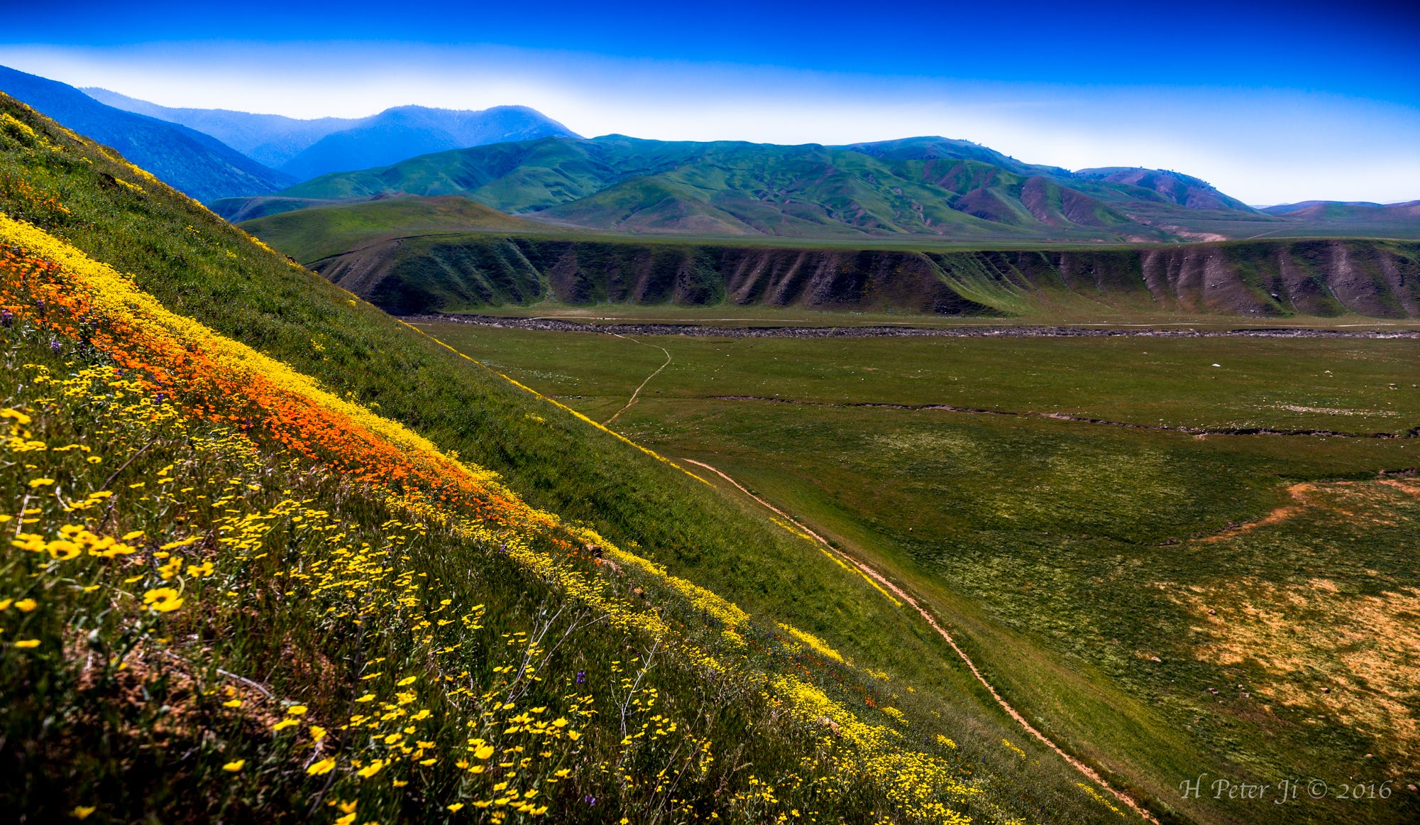
It was a very mild incline and was in fact quite pleasant. Also, it was quite scenic in that these rolling highlands create interesting dynamics in this open grassland.

Once we reached the end of the mildly inclining part of the trail, we were rewarded with the first look of the open land of Wild Wolves Preserve.

After the quick break, we continued our hike toward the top of the hill. We were still on Tule Elk Trail, which runs by the Tule Elk viewing area. According to the Wild Wolves Preserve website, the Tule Elk herd has grown to more than 400 elk. However, we were in no such luck of catching a sight any of them.

If you look at the hilltop closely, you could see other hikers standing there. While the trail goes up diagonally to the right and then switches back to the left to reach the top, one can climb straight up, which I did with a lot of huffing and puffing.
Note: I didn’t get to see them because I skipped the switchback, but there was a rattle snake that the group saw. According to the Wind Wolves Preserve website, they don’t attack you first unless you startle them. Just be aware that they are out there. Keep your eyes peeled.

Once reaching the top of the hill that Tule Elk Trail led us to, we were able to see Bakersfield and other nearby towns under a thick blanket of smog and the adjacent mountains, like Cummings Mountain, Tehachapi Mountain and Bear Mountain, shrouded in it.

If you look at the hilltop photo again, you would notice there are two humps. This off trail (in the photo right above) cuts through the second hump (after a short steep incline). This spot gives a better vantage point for Tule Elk viewing. We didn’t see any elk, but the sight of the mountain line from here was quite impressive.

After the first hilly part of the trail, Tule Elk Trail just goes around low rolling hills covered with grass.

Then, we ran into this. A huge herd of sheep spread across one section of the grassland with the backdrop of the hills. Particularly, this one with a calf behind him/her was quite interested in us. He stuck around for quite a bit.

Those two prominent hills were always in sight. At first I thought that these must’ve been mountains with decent elevations. But it turned out that they were not. They were just the bottom hills of Eagle Rest Peak (6,004'). However, it is a good starting point if you want to hike Anthony Peak (6,847'), San Emigdio Mountain (7,493') and Brush Mountain (7,047'). Of course, you can hike the last two from the opposite side of the mountains where the trailheads are located on CA-95.

Tule Elk Trail continued but we still didn’t see any sign of elk on the other side of the wire fence.

This little guy didn’t move a bit as I got closer and closer to take good shots of him. We thought at first that it was somebody’s prank that it was a gopher statue because he didn’t move at all. Then, it eventually plopped down on alert. It was quite amusing how long he actually stood still like a real statue.

This was our first popular-wildflower sight — California poppy. But it wasn’t that thrilling because there wasn’t much. We took some shots and continued our Wind Wolves Preserve hike.

Our hike on the part of Tule Elk Trail from the junction where it splits into two to Reflection Pond Trailhead was about 1 1/3 miles or so. And believe me. There was no shade up to this point. So, make sure that temperature is in your favor when you hike this trail. It was quite pleasant for us when the high reached up to only low-70F degrees. A bit of cool breeze added extra delightfulness.
However, later in the afternoon when we were returning on El Camino Viejo Bike Trail, we saw a few hikers who brought dogs with them and that it was clear that the dogs were getting overheated.

We soon reached our destination for lunch break, and there was a little creek behind this bulletin board (in the photo right above). The water was actually running although I wondered if it would dry up in the scorching hot summer days.
Note: Speaking of Reflection Pond, I didn’t get to hike up and over the hill to check it out because the wildflower beds were more interesting, but later I was told that there was no pond. It was just a piece of dried sunken land. Just like Dry Lake in Mt. San Gorgonio.
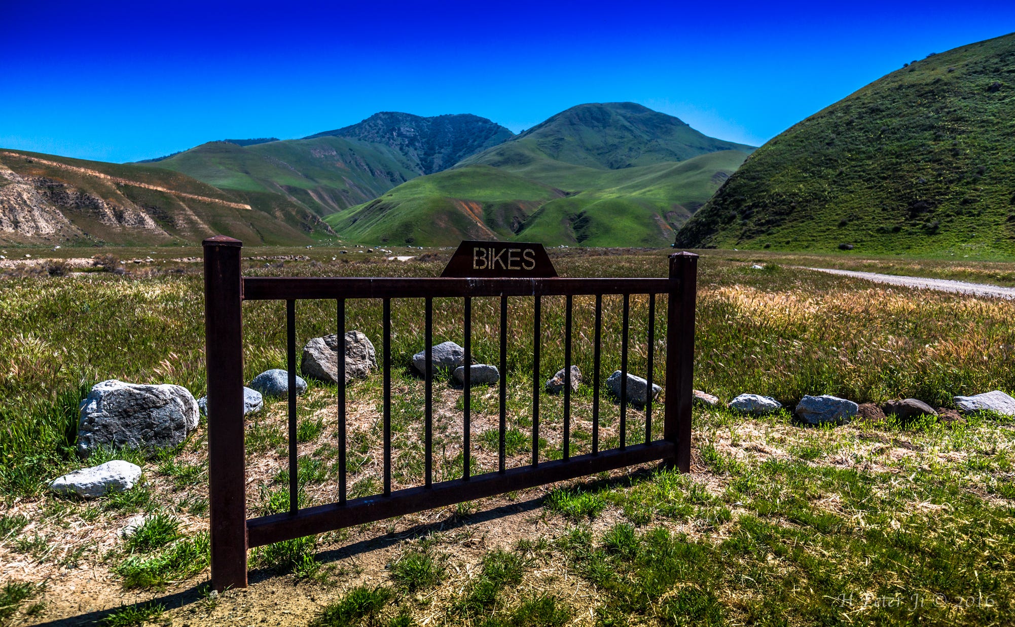
As it is shown above, Wind Wolves Preserve is a popular place for mountain bikers to be. Although no bike was parked here when we were there, I was told that it gets quite busy on weekends.

After lunch, the moment came. We headed up for the flower beds.

It turned out that it was a rather steep hill to climb using 4 limbs at some parts, so those who didn’t want to climb just took photos from the bottom of the hill and continued on the remaining part of the trail and over the ridge of the hill to check out Reflection Pond instead. Only three of us started climbing.

I wish I were a lot closer to them, but I could no longer find sturdy footing. So I decided to capture them as best as I could from where I was.

As they were found, it was good enough for me.

They were worth the drive and the hike. Of course, the pleasant company made it worthwhile as well.

On our way back to the parking lot, the wind picked up nicely. It wasn’t warm to begin with, however, the cool breeze certainly made our walk back to the Visitor Center quite pleasurable. Once again, except for the restroom and some trees around it, which were located a mile north from Reflection Pond Trailhead, there was no shade during the entire hike of 11.4 miles.

The following is the stats recorded with Gaia GPS;
11.4 mi Distance
4 hrs 7 min Moving Time
31:14 min/mi Pace
5 hrs 57 min Total Time
1 hrs 49 min Stopped Time
2.8 mph Moving Speed
1.9 mph Avg Speed
1819 ft Ascent
1729 ft Descent
We weren’t hiking fast and I stayed behind quite often to take photos, so I would say 4 hours of moving time is plenty. However, if you want to take longer breaks and frequently, you should factor those in.
I stopped recording two times when we took two rather long breaks. The first was at the top of the lower hill where there was a bench, which is about 2 miles in, and the other was at Reflection Pond Trailhead.
There are more trails to explore than just Tule Elk Trail and El Camino Viejo Bike Trail. For instance, San Emigdio Trail also goes all the way to Reflection Pond Trailhead from the Crossing. I was told that hikers end up walking on that trail due to the heavy volume of mountain bikers and shuttle bus services between the Crossing and Reflection Pond Trailhead on El Camino Viejo Bike Trail on weekends.
As I mentioned earlier, Reflection Pond Trail goes up and over the hill ridge to the now dry Reflection Pond, and technically, there are more trails beyond that. The Windland Conservancy, which takes care of Wind Wolves Preserve, calls them unimproved roads. Explore them on your discretion.
And last but not least important, El Camino Viejo Bike Trail turns into El Camino Viejo Wilderness Trail at the bottom of the mountain hillside, which you can take to reach Eagle Rest Peak and beyond.
Once again, when you do long hikes, please, make sure to bring an appropriate amount of water with you.
Have you done Spring wildflower hikes at Wild Wolves Preserve? How did it go? Did you capture some good wildflower moments? Have you hiked or mountain biked beyond Reflection Pond Trailhead? If you did, how was it?
Thanks for reading.
This article was originally published on Inherently Adventurous blog on March 27, 2016. If you enjoyed what I’ve written on Medium, you can read other adventure posts like this on Inherently Adventurous and enjoy more photos on 500px, Flickr and my photography portfolio site with Wix.